Overview
What Radiometric Surveying Measures
Gamma-ray spectrometry measures naturally occurring radiation from uranium, thorium and potassium, along with anthropogenic cesium. Those readings map geological variation and act as pathfinders, pointing to gold, copper and silver as well as uranium itself. The same data supports NORM assessment, environmental monitoring and regulatory compliance.
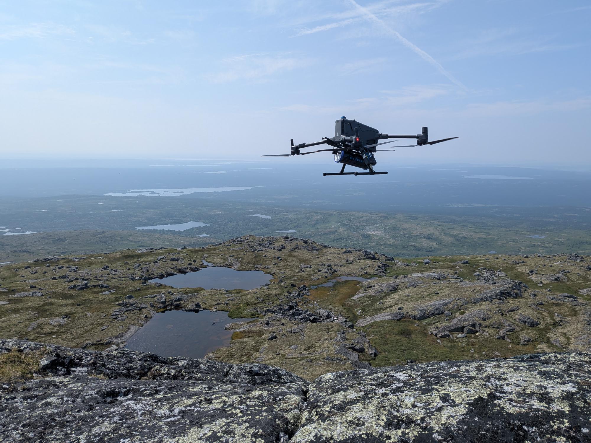
Altomaxx flies the survey by drone at low altitude with terrain-following control, using Medusa gamma-ray spectrometers with SPH Engineering integration. The result is high-resolution radiometric mapping over the blocks that matter, on ground that is slow or unsafe to cover any other way.
60 line-km
Of high quality data, per drone, per day
150 line-km
Daily coverage potential with two crews on one property
5–100 m
Line spacing, flown to suit the target
Watch
Radiometric Surveys in the Field
See how Altomaxx flies drone-based radiometric surveys, from mission planning to gamma-ray data collection.
Choosing a Method
How the Survey Methods Compare
Radiometric surveys are flown from aircraft, walked on the ground, or flown by drone. Each has a place in a programme, and the real question is not which is cheapest per day, but what a field day returns. The drone sits between the other two: more detail than an aircraft can resolve, more ground than a crew can walk.
|
Aircraft |
Altomaxx Drone |
Ground Crew |
| Resolution |
Coarse. Higher altitude, faster, wider line spacing |
High. Low altitude, tight line spacing, consistent sensor height |
Highest, point by point |
| Coverage |
Fast over large regions |
Around 60 line-km per drone, per day |
Slow. A crew walks every line |
| Cost |
Highest. Mobilisation, fuel and flight hours |
Mid-range cost for the highest data return per field day |
Lower day rate, but crew days add up over large ground |
| Terrain |
Unaffected, but far from the ground |
Flies over bog, brush and rock at consistent height |
Limited by exactly the terrain that matters |
| Best for |
Regional reconnaissance. Finds the belt |
Target definition. Resolves anomaly geometry, ranks drill targets |
Small areas and spot follow-up |
Planning a survey season?
Send us a target area, the relief and vegetation, and the decision the data has to support. We will come back with a survey design, a mobilisation plan and a price.
Request a Survey Design
The System
What We Fly
SensorMedusa Radiometrics MS-700 gamma-ray spectrometer with a 700 ml CsI detector
IsotopesK-40, U-238, Th-232 and Cs-137 analysed online, full spectrum recorded along every line
PositioningMulti-band GNSS, RTK capable to centimetre level
Flight ManagementSPH Engineering SkyHub onboard computer with UgCS mission planning
Terrain FollowingOnboard radar and laser altimetry, flown against existing DEM and DSM data
EnvironmentMinus 20 to plus 65 C, IP65. Arctic to desert
Quality ControlCalibration checks, repeat lines and daily data review on site. A line that needs re-flying is re-flown the next morning
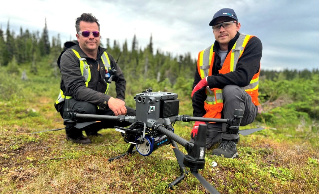
The Medusa gamma-ray spectrometer integrated on the survey drone and ready for the first line.
Survey speed of 4 to 5 metres per second, line spacing from 5 to 100 metres set to the target rather than to the aircraft, and consistent ground clearance across variable topography.
Deliverables
What You Receive
Every survey closes with a data package your geologists can open the day it arrives, in the formats they already work in.
✓Gridded K, eU and eTh concentration maps
✓Ratio products and RGB ternary imagery for lithology and alteration
✓Total count grids where required
✓Ranked anomaly list with coordinates for ground follow-up
✓GeoTIFF, CSV, shapefile and Geosoft-ready exports
✓Terrain model and flown-height record for every line
✓Survey report covering method, calibration and quality control
Proven on a Known Deposit
Tested Against Two Airborne Surveys
Over a known uranium deposit in the Canadian sub-Arctic, Altomaxx flew drone radiometrics across ground already surveyed twice from the air. The drone dataset out-resolved both the earlier helicopter survey and the earlier fixed-wing coverage. It resolved the internal geometry of the known anomaly and surfaced additional anomalies that geologists followed up on foot, supporting new mineralisation findings.
Anomalies still need geological follow-up to interpret. What changes is how few you have to chase, and how confident you are in the ones you do.
2
Earlier airborne surveys out-resolved over identical ground
1
Field season in place of several seasons of ground radiometrics
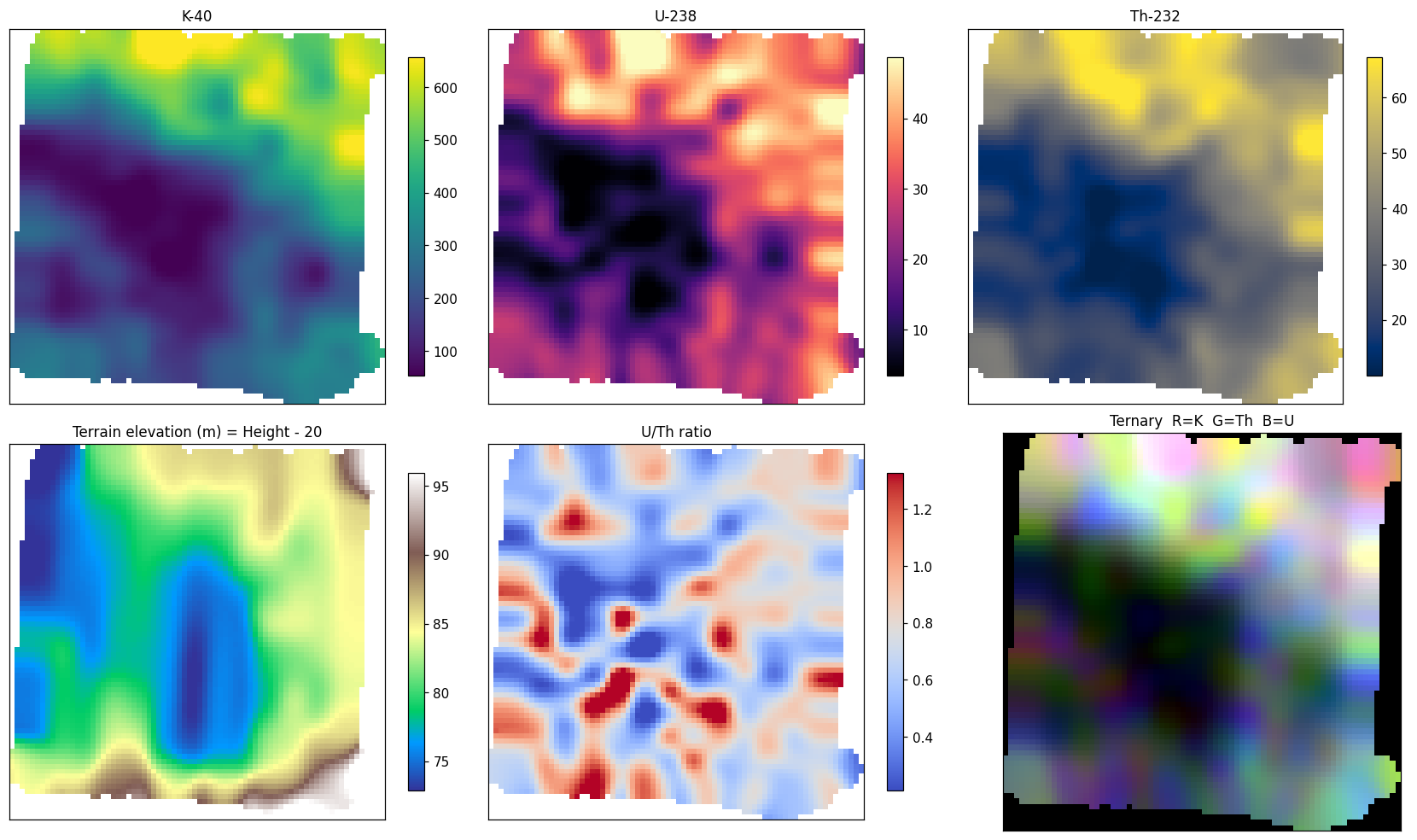
Product set from the survey block: K-40, U-238 and Th-232 concentration grids, terrain model, U/Th ratio imagery and RGB ternary composite. Gridded at 25 m. Click the image to view it at full size.
See what this resolution is worth on your own ground. A small proof survey over your two or three highest-ranked anomalies is often the fastest way to find out.
Start With a Proof Survey
Common Questions
What Clients Ask Before a Survey
We already have airborne radiometrics.
That is the reconnaissance layer. It cannot tell you which anomaly is worth a hole. The drone flies detail over the blocks the regional survey flagged.
Our field crew does this on the ground.
Ask how many days per season, and how many anomalies actually get reached. The drone covers the same lines without putting people on the ground.
What size of project fits best?
The sweet spot runs from a few hundred to a couple of thousand line kilometres, which suits drill prioritization over defined blocks. It also fits claim maintenance, where required assessment spending can return high-resolution radiometric data on the ground you hold.
What are the limits of radiometrics?
Gamma spectrometry reads the top few tens of centimetres. Vegetation, water, snow and thick sand attenuate the signal, and deep sandstone or roll-front targets are not radiometric targets. We say that before you ask.
Is Altomaxx a geophysics company?
Altomaxx is a drone services company, and that is the point. The sensor is Medusa and the flight management is SPH Engineering, the same supply chain the airborne contractors use. We fly it lower, slower and closer.
Will this work in our country?
We mobilise internationally, and permitting, airspace approval and radioactive source import are handled during scoping rather than as a surprise.